
Bay Area Hikes in the North Bay
- Aug 14, 2019
- 4 min read
No matter where you are in the Bay Area, a unique, spectacular hike is only a hop, skip, and a jump away! However, whether you’re California-born or a first-time visitor, you’ll quickly notice the faults in public transit to even heavily populated zones; this means beautiful parks and open spaces in the periphery of the cities are difficult to access.
For those of you who do have a car or can hitch a ride with a friend (or Ridj-it), this series lists some inspiring trails for every part of the Bay. Starting at the top, we have the North Bay. Sandwiched between cozy nooks of beaches on the west side and tranquil marinas on the east are the wise and towering redwoods. The North Bay is full of striking natural beauty.
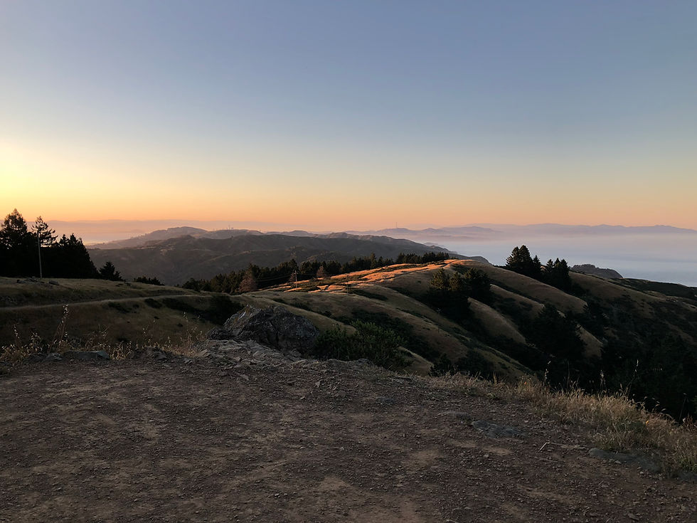
Area: Mount Tamalpais Hike: Pantoll Campground to Stinson Beach Loop Info: 3.8 miles; 1500 feet elevation gain; Moderate; Loop
To get a full view of the blissful lifestyle in Marin, I suggest starting at the Pantoll Campground in Mount Tamalpais. There you’ll find a parking lot there with an $8 day parking fee right next to the Steep Ravine trail head. Take your time wandering through the whispering redwoods along Webb Creek and marvel as the forest opens up into a field of wildflowers with the Pacific Ocean teaming with its teal brilliance in the distance. After the descent, you’ll be ready to cool down with some ice cream at the Parkside Snack Bar and rest in the breeze at Stinson Beach. Fill your water bottle before the ascent, and be sure to take the same trail back until the fork and veer right to start on the Dipsea Trail. Take the Coastal Fire Road towards to top of the trail to start on the Old Mine Trail back to your car.
Area: Muir Woods Hike: Main Trail to Hillside Info: 2.0 miles; 90 feet elevation gain; Easy; Loop
As you’re driving out from the affectionately-named Mount Tam, make sure to pay a compulsory visit to Muir Woods National Monument. Keep in mind that parking and shuttle reservations are required ahead of time! The entrance fee is $15 for adults, which you’ll realize is a steal upon entering the park. These ancient trees were once a part of the local flora all over the world and are now only found in a narrow strip running from Big Sur to the California-Oregon border. Keep your eyes peeled for the array of local animals who live among the giants. Start on the Main Trail and take Bridge 4 to the Hillside Trail. On the way back take Bridge 2 to the Main Trail. The visitors center has a variety of information and cute locally made gifts to make your loved ones jealous.
Area: Napa Hike: Goodspeed Trail Info: 5.9 miles; 2,200 feet elevation gain; Moderate; Out and Back If you didn’t visit a winery, were you even in Northern California? Napa Valley is world-renowned for smooth reds and fruity whites, but the hidden gem of wine country is the luscious green! The Goodspeed trail is not too far off the beaten path near Kenwood. Park at the Goodspeed-Nattkemper Trailhead for $8, and take this moderate trail up to the peak of Hood Mountain to catch a glimpse of the perfect rows of vines cut by creeks and interspersed with woodland green spaces. At the end of the hike, drive right down Adobe Canyon Road towards Sonoma Highway and stop for a drink at Chateau St. Jean Winery to enjoy a tasting for as low as $15 in a gorgeous Sonoma estate.

Area: Point Reyes Hike: Estero Trail Info: 8 miles; 200 feet elevation gain; Easy; Out and Back Out to the west of Napa, you’ll find Point Reyes National Seashore. The redwoods and pines thin and sunshine pours onto this coastal trail. Parking for this trail is off Home Ranch Road. The Estero trail leads to a pleasant wooden bridge. Cross over and at the fork take the Sunset Beach Trail to Drake Estuary. Enjoy the coastal life like crabs and mussels, but watch out for the Manowars that wash up after storms!
Area: Marin Headlands Hike: View the Golden Gate Info: 10.1 miles, 1900 feet elevation gain; Difficult; Loop For the perfect Bay Area photo-op, choose this route for a panoramic view of the Golden Gate Bridge from Marin. Start by parking near the Coastal Trailhead off Bunker Road near the Presidio Riding Club. Take a left on the Rodeo Valley Trail and feel immediately enveloped in the cool shade of the redwoods. Take the short Bobcat trail to the left and make a right on the Miwok Trail. The next turn is right at Old Springs Trail to a right onto Marincello Trail. Go left up Alta Trail and right at the residential road where you can find the Rodeo Valley Trail again. Walk down this trail to your car, and however convoluted this may seem, the route is worth the trip. Getting a great view of the city from the outside truly reveals the diverse topography of the region.
These are just a few of the myriad of beautiful natural spaces in North Bay, so the conscientious hiker need not worry, there is no wrong choice! Just enjoy your time exploring in one of the most naturally-diverse regions of the Bay Area.
Comments